Rain and snow forecast for parts of central-southern Italy
Four Italian regions were placed under a 'yellow' weather alert on Friday, with heavy rains and snowfall expected in parts of the Centre-South.
Italy's Civil Protection department issued the alerts for the central-eastern regions of Abruzzo and Molise and the southern regions of Calabria and Sicily on Thursday, warning of storms and a possible flood risk.
A yellow alert is a low-level risk warning, below a moderate 'orange' or high 'red' threat, but signals a possible danger to public safety and the risk that lives could be lost in unforeseen circumstances.
READ ALSO: EXPLAINED: What do Italy's storm alerts mean?
📆 Venerdì #15dicembre
💨 Venti fino a burrasca in arrivo al Centro-Sud
🔔🟡 #allertaGIALLA meteo-idro su settori di Abruzzo, Molise, Calabria e Sicilia.
🔎 Leggi l'avviso meteo del #14dicembre 👉 https://t.co/ocohVnwH1f #protezionecivile pic.twitter.com/39ToYyX3xW
— Dipartimento Protezione Civile (@DPCgov) December 14, 2023
The Marche, Umbria, Lazio, Abruzzo, Molise, Puglia, Campania, Basilicata, Calabria and Sicily regions also faced the possibility of gale-force winds from Friday morning, the department warned.
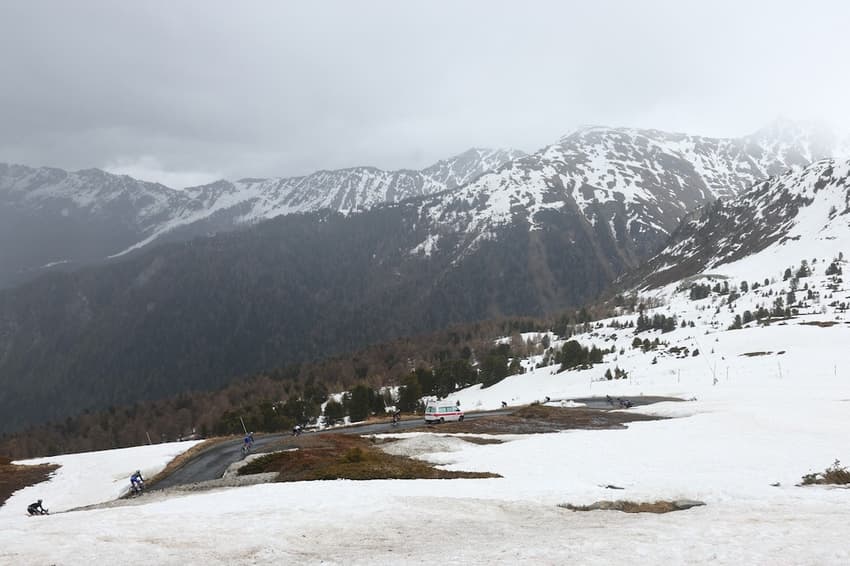
Snow was anticipated in high-altitude areas of the Apennines mountain range in Marche, Abruzzo and Molise, as the cold front was expected to lower the snow level.
Clear skies, by contrast, were forecast for northern alpine areas of the country, as well as in central regions away from the Adriatic coast, though temperatures were expected to drop across the country.
By the end of the weekend, however, the weather was set to change dramatically as a block of high pressure from northern Europe is expected to bring a 'thermal swing' to the Italian peninsula from Sunday afternoon.
Temperatures could rise as high as 10C above the seasonal average in the Alps, meteorologists said.
Comments
See Also
Italy's Civil Protection department issued the alerts for the central-eastern regions of Abruzzo and Molise and the southern regions of Calabria and Sicily on Thursday, warning of storms and a possible flood risk.
A yellow alert is a low-level risk warning, below a moderate 'orange' or high 'red' threat, but signals a possible danger to public safety and the risk that lives could be lost in unforeseen circumstances.
READ ALSO: EXPLAINED: What do Italy's storm alerts mean?
📆 Venerdì #15dicembre
— Dipartimento Protezione Civile (@DPCgov) December 14, 2023
💨 Venti fino a burrasca in arrivo al Centro-Sud
🔔🟡 #allertaGIALLA meteo-idro su settori di Abruzzo, Molise, Calabria e Sicilia.
🔎 Leggi l'avviso meteo del #14dicembre 👉 https://t.co/ocohVnwH1f #protezionecivile pic.twitter.com/39ToYyX3xW
The Marche, Umbria, Lazio, Abruzzo, Molise, Puglia, Campania, Basilicata, Calabria and Sicily regions also faced the possibility of gale-force winds from Friday morning, the department warned.
Snow was anticipated in high-altitude areas of the Apennines mountain range in Marche, Abruzzo and Molise, as the cold front was expected to lower the snow level.
Clear skies, by contrast, were forecast for northern alpine areas of the country, as well as in central regions away from the Adriatic coast, though temperatures were expected to drop across the country.
By the end of the weekend, however, the weather was set to change dramatically as a block of high pressure from northern Europe is expected to bring a 'thermal swing' to the Italian peninsula from Sunday afternoon.
Temperatures could rise as high as 10C above the seasonal average in the Alps, meteorologists said.
Join the conversation in our comments section below. Share your own views and experience and if you have a question or suggestion for our journalists then email us at [email protected].
Please keep comments civil, constructive and on topic – and make sure to read our terms of use before getting involved.
Please log in here to leave a comment.