Italy braces for cold snap with snow forecast at low altitudes
Much of Italy is set to see a major dip in temperatures this weekend, with snowfall expected at low-altitude locations across the north and centre of the country.
After experiencing unseasonably warm temperatures this week – the mercury hovered around the 20C mark in Sicily, Sardinia, Puglia and parts of Calabria on Thursday – things are set to change drastically as Italy faces a cold snap this weekend, according to the latest forecasts.
Cold air fronts sweeping in from eastern Europe are expected to reach the north of the country from the early hours of Friday, with all regions in the area forecast to see an abrupt four- to five-degree dip in daytime temperatures and below-zero conditions overnight.
The sudden drop in temperatures is expected to favour abundant snowfall at locations across the entire Alps mountain range but should also bring snow to lower altitudes.
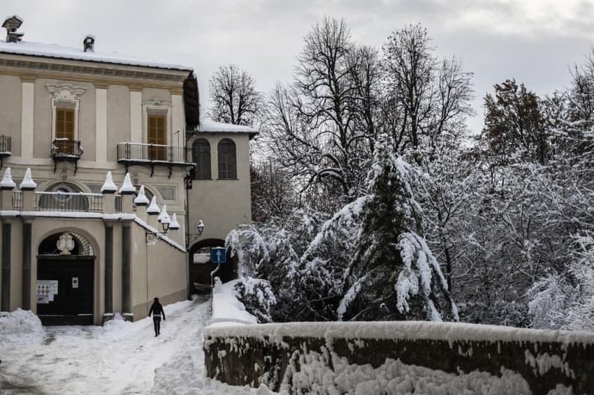
In particular, locations in Veneto, Lombardy and Emilia Romagna standing as low as 300 metres above sea level may all get to see snow for the first time this year, though snowfall there won't be as intense as in the mountains.
#Meteo #Italia: Giovedì precipitazioni su #Alpi occidentali e #Appennino centrale poi dalla notte aria fredda da nord con primi #rovesci ⛈️ su Alpi centro orientali e Nord Est. Weekend aria artica ❄️, pioggia e #neve a quote molto basse al Nord con episodi di #graupel in pianura. pic.twitter.com/PoFHBBSfBk
— Meteoplanet.it (@meteoplanetit) January 18, 2024
The incoming cold front is expected to move down the peninsula on Saturday, bringing a five- to seven-degree temperature drop and stormy conditions to regions in the centre and south.
Parts of the Apennines (particularly mountain towns and villages in Abruzzo, Molise and Campania) should experience generous snowfall during the day, with snow expected as far down as 400 metres of altitude in some cases.
Meanwhile coastal areas and the two major islands, Sicily and Sardinia, are forecast to see medium- to strong-intensity storms on Saturday.
It was unclear how long the incoming weather front would linger over the country, though some forecasters have said cold and stormy conditions may well continue into next week, with milder weather only reestablishing itself across the country by mid-week.
Comments (1)
See Also
After experiencing unseasonably warm temperatures this week – the mercury hovered around the 20C mark in Sicily, Sardinia, Puglia and parts of Calabria on Thursday – things are set to change drastically as Italy faces a cold snap this weekend, according to the latest forecasts.
Cold air fronts sweeping in from eastern Europe are expected to reach the north of the country from the early hours of Friday, with all regions in the area forecast to see an abrupt four- to five-degree dip in daytime temperatures and below-zero conditions overnight.
The sudden drop in temperatures is expected to favour abundant snowfall at locations across the entire Alps mountain range but should also bring snow to lower altitudes.
In particular, locations in Veneto, Lombardy and Emilia Romagna standing as low as 300 metres above sea level may all get to see snow for the first time this year, though snowfall there won't be as intense as in the mountains.
#Meteo #Italia: Giovedì precipitazioni su #Alpi occidentali e #Appennino centrale poi dalla notte aria fredda da nord con primi #rovesci ⛈️ su Alpi centro orientali e Nord Est. Weekend aria artica ❄️, pioggia e #neve a quote molto basse al Nord con episodi di #graupel in pianura. pic.twitter.com/PoFHBBSfBk
— Meteoplanet.it (@meteoplanetit) January 18, 2024
The incoming cold front is expected to move down the peninsula on Saturday, bringing a five- to seven-degree temperature drop and stormy conditions to regions in the centre and south.
Parts of the Apennines (particularly mountain towns and villages in Abruzzo, Molise and Campania) should experience generous snowfall during the day, with snow expected as far down as 400 metres of altitude in some cases.
Meanwhile coastal areas and the two major islands, Sicily and Sardinia, are forecast to see medium- to strong-intensity storms on Saturday.
It was unclear how long the incoming weather front would linger over the country, though some forecasters have said cold and stormy conditions may well continue into next week, with milder weather only reestablishing itself across the country by mid-week.
Join the conversation in our comments section below. Share your own views and experience and if you have a question or suggestion for our journalists then email us at [email protected].
Please keep comments civil, constructive and on topic – and make sure to read our terms of use before getting involved.
Please log in here to leave a comment.