Italy braces for storms as warm autumn weather ends
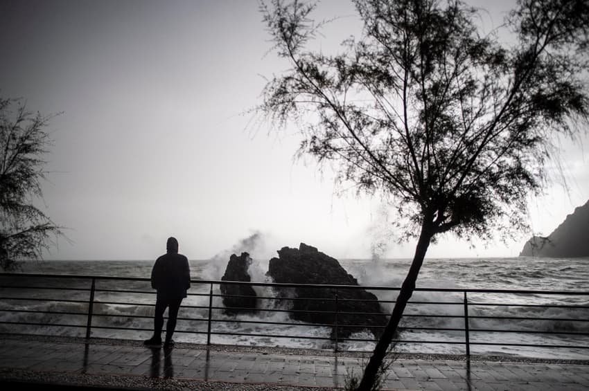
A long spell of unseasonably warm weather across Italy is expected to end on Monday, with forecasters warning that a series of storms is on the way.
A short spell of warm weather in early November is not unusual in Italy - it’s referred to as a ‘St Martin’s summer’ - but this year it has lasted around a month in many parts of the country.
The mild autumn weather is now set to come to an abrupt end as a wave of cyclones will move in from the Atlantic this week, said IlMeteo.it director and meteorologist Antonio Sanò in a forecast on Monday.
The north-west of Italy will see rain on Monday and snow at high altitudes, while showers are expected in central regions.
Weather elsewhere will be changeable, forecasts said, before stormy weather moves to the centre-south by the middle of the week.
READ ALSO: How climate change is creating disputes on the Swiss-Italian border
Conditions are expected to be milder on Thursday before a second cyclone moves in on Friday and Saturday, bringing heavy rain and scattered local thunderstorms to much of the country, Sanò said.
Tra poco tante #piogge e più freddo » #meteo su https://t.co/9Z7Sw0leS6
— IL METEO.it (@ilmeteoit) November 14, 2022
The late arrival of stormy autumn weather will bring temperatures back down to seasonal averages - though sea temperatures remain unusually high, Sanò warned.
This difference in temperatures, meteorologists explain, creates heavy rain clouds bringing the risk of sudden bursts of extreme rainfall; a phenomenon known in Italian as a bomba d’acqua, or ‘water bomb’, which often causes flash flooding.
READ ALSO: Italy records five times more extreme weather events in ten years
Experts say climate change is responsible for changing temperatures which are boosting the intensity and frequency of ‘extreme weather events’ such as floods.
The number of such events in Italy, including droughts, storms, floods, hailstorms, strong winds and tornadoes, has already been 42 percent higher in 2022 so far than last year.
Comments
See Also
A short spell of warm weather in early November is not unusual in Italy - it’s referred to as a ‘St Martin’s summer’ - but this year it has lasted around a month in many parts of the country.
The mild autumn weather is now set to come to an abrupt end as a wave of cyclones will move in from the Atlantic this week, said IlMeteo.it director and meteorologist Antonio Sanò in a forecast on Monday.
The north-west of Italy will see rain on Monday and snow at high altitudes, while showers are expected in central regions.
Weather elsewhere will be changeable, forecasts said, before stormy weather moves to the centre-south by the middle of the week.
READ ALSO: How climate change is creating disputes on the Swiss-Italian border
Conditions are expected to be milder on Thursday before a second cyclone moves in on Friday and Saturday, bringing heavy rain and scattered local thunderstorms to much of the country, Sanò said.
Tra poco tante #piogge e più freddo » #meteo su https://t.co/9Z7Sw0leS6
— IL METEO.it (@ilmeteoit) November 14, 2022
The late arrival of stormy autumn weather will bring temperatures back down to seasonal averages - though sea temperatures remain unusually high, Sanò warned.
This difference in temperatures, meteorologists explain, creates heavy rain clouds bringing the risk of sudden bursts of extreme rainfall; a phenomenon known in Italian as a bomba d’acqua, or ‘water bomb’, which often causes flash flooding.
READ ALSO: Italy records five times more extreme weather events in ten years
Experts say climate change is responsible for changing temperatures which are boosting the intensity and frequency of ‘extreme weather events’ such as floods.
The number of such events in Italy, including droughts, storms, floods, hailstorms, strong winds and tornadoes, has already been 42 percent higher in 2022 so far than last year.
Join the conversation in our comments section below. Share your own views and experience and if you have a question or suggestion for our journalists then email us at [email protected].
Please keep comments civil, constructive and on topic – and make sure to read our terms of use before getting involved.
Please log in here to leave a comment.